Author: Abby Mebane
Photos by Cam Hughes and Abby Mebane
Stop 1 – Wilmor Lake, Co
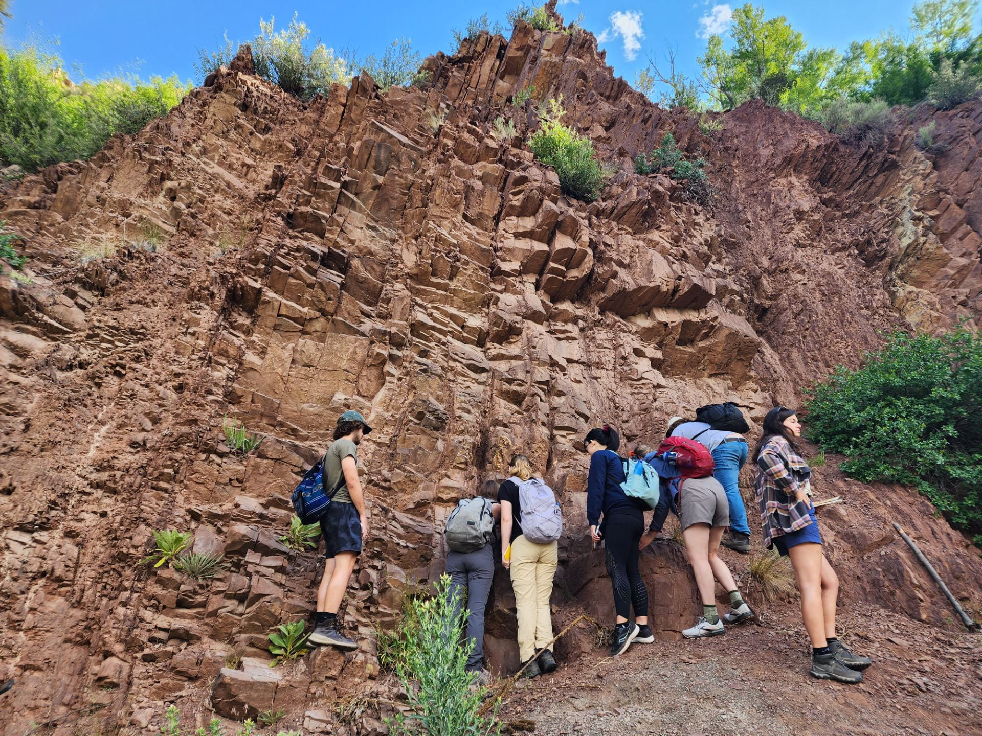
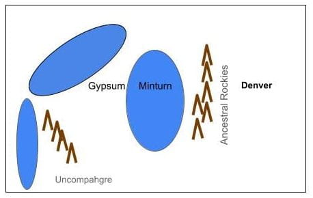
Our first stop was Wilmor Lake rest stop, east of Minturn. Audrey Putnam was leading today’s field trip. We saw an outcrop of the Pennsylvanian Eagle Valley Formation. It is a steeply dipped sedimentary rock unit and fine grained, suggesting that the grains are far from the source. There were also visible mica crystals in the red rock. This indicates that the outcrop is a metasedimentary rock because mica weathers easily and the high volume of mica indicates the beginning of metamorphic processes. We also observed veins of gypsum embedded in the rock. We discussed how gypsum forms from evaporating water. This likely occurred when part of the ancient ocean covering Colorado evaporated, leaving behind gypsum and halites.
Stop 2- Gypsum outcrop on road to Dotsero Crater
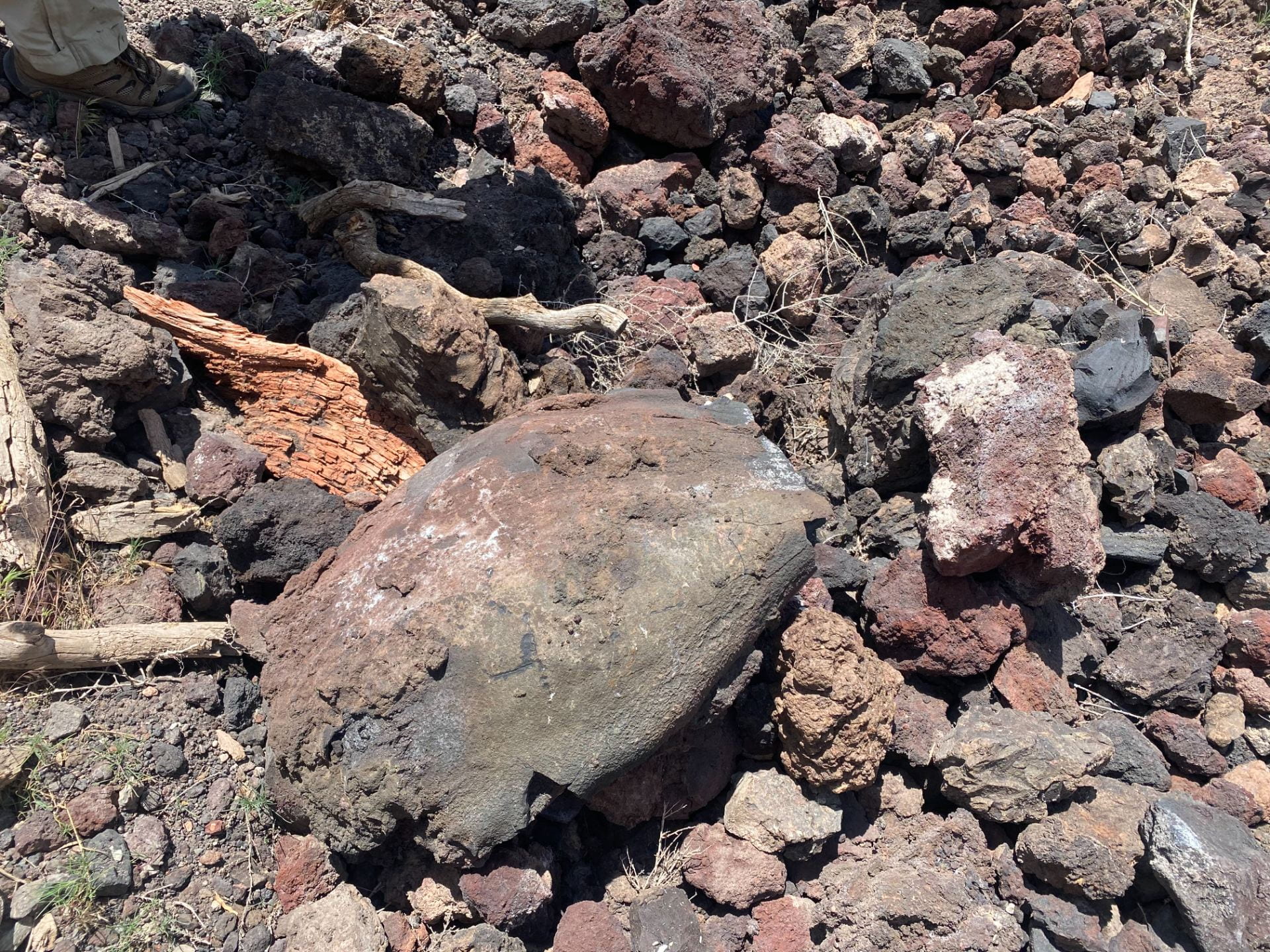
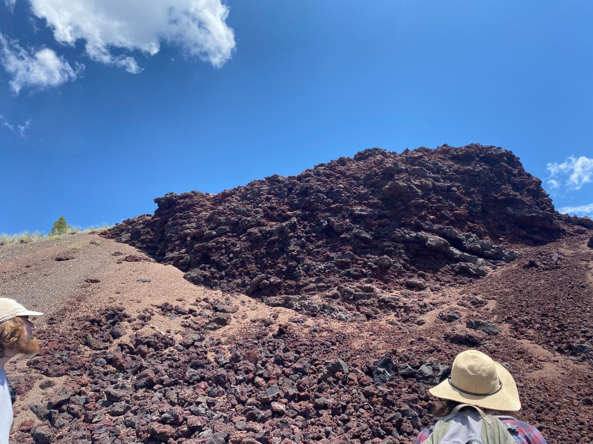
We stopped near a large gypsum outcrop and examined some of the volcanic rocks. The gypsum outcrop was easy to break with our hands and was surrounded by basaltic lava flows. The volcanic rocks were porous red and black basalts. The basalt was finer grained than the granite we had seen on a previous day. We heard from Audrey Putnam, Will Larsen, Cam Hughes, and Stewart Williams about the benefits and limitations of carbon sequestration into mafic rocks, and the basics of how magma forms and creates volcanic explosions. Among the volcanic rocks we found a bomb, a large piece of magma that was ejected during the eruption. It is large and rounded with characteristic markings from traveling through the air at high speeds and cooling rapidly. We also observed sedimentary xenoliths in the basalt. This tells us that the volcano likely erupted through sedimentary rock and it was a relatively fast explosion because the sedimentary xenoliths are still intact.
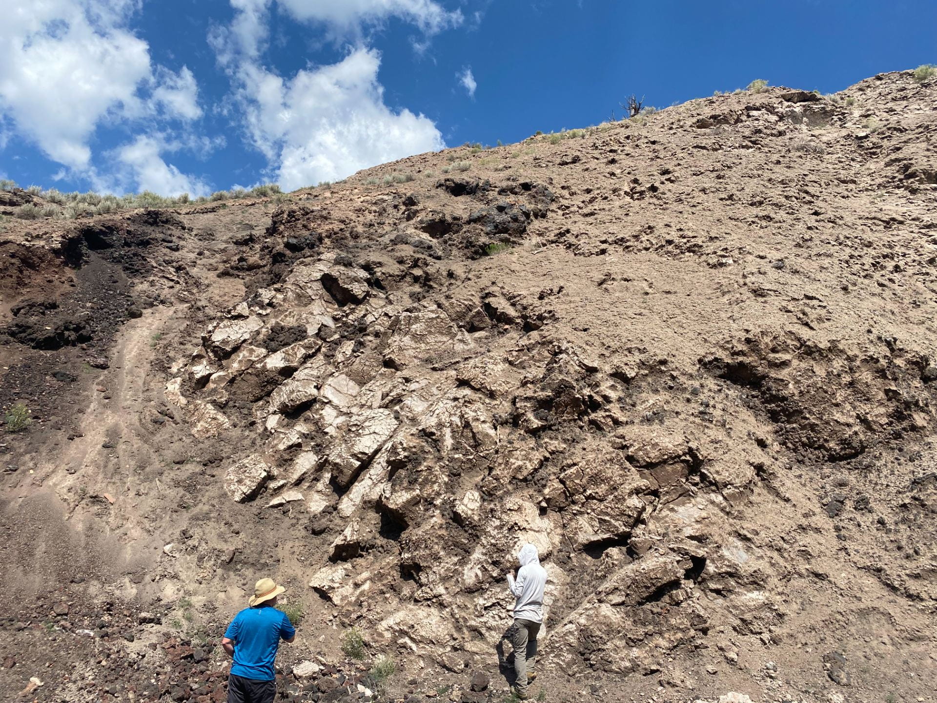
We also learned about a’a and pahoehoe lava flows. Aa flows are usually rougher and create bumpy beds of rock. Pahoehoe flows are smoother, and create ripple-like structures.
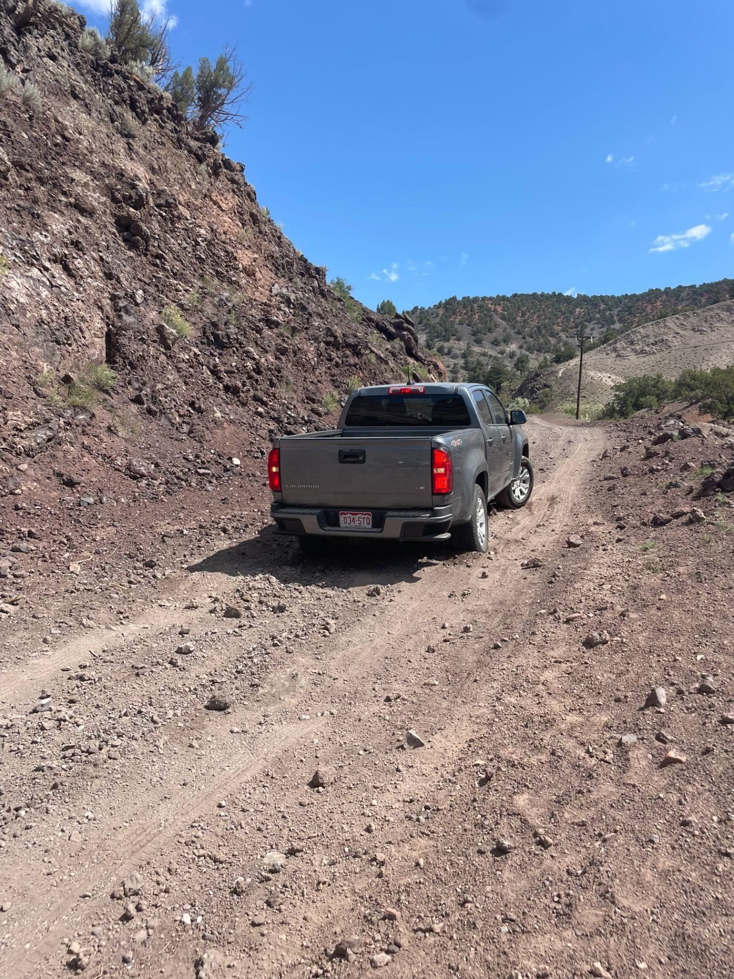
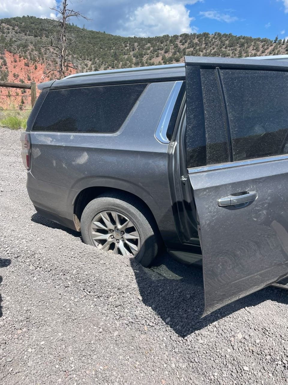
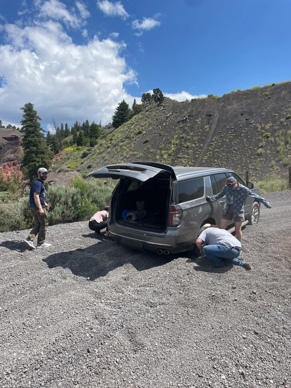
Road troubles!
On our way up to the Dotsero crater, our cars ran into some trouble going up the gravel mountain roads! We had to dig one of them out and give it a push to get back onto firmer road.
Stop 3 – Dotsero Crater
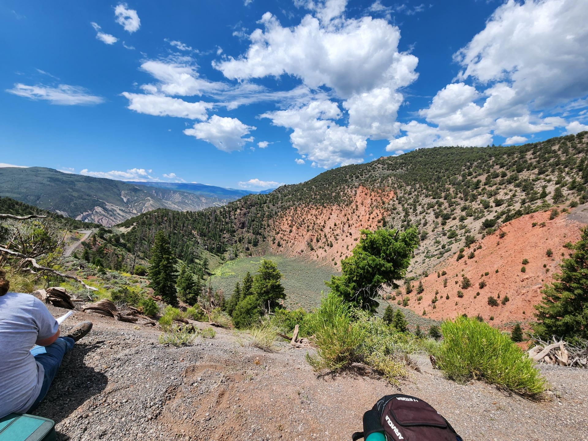
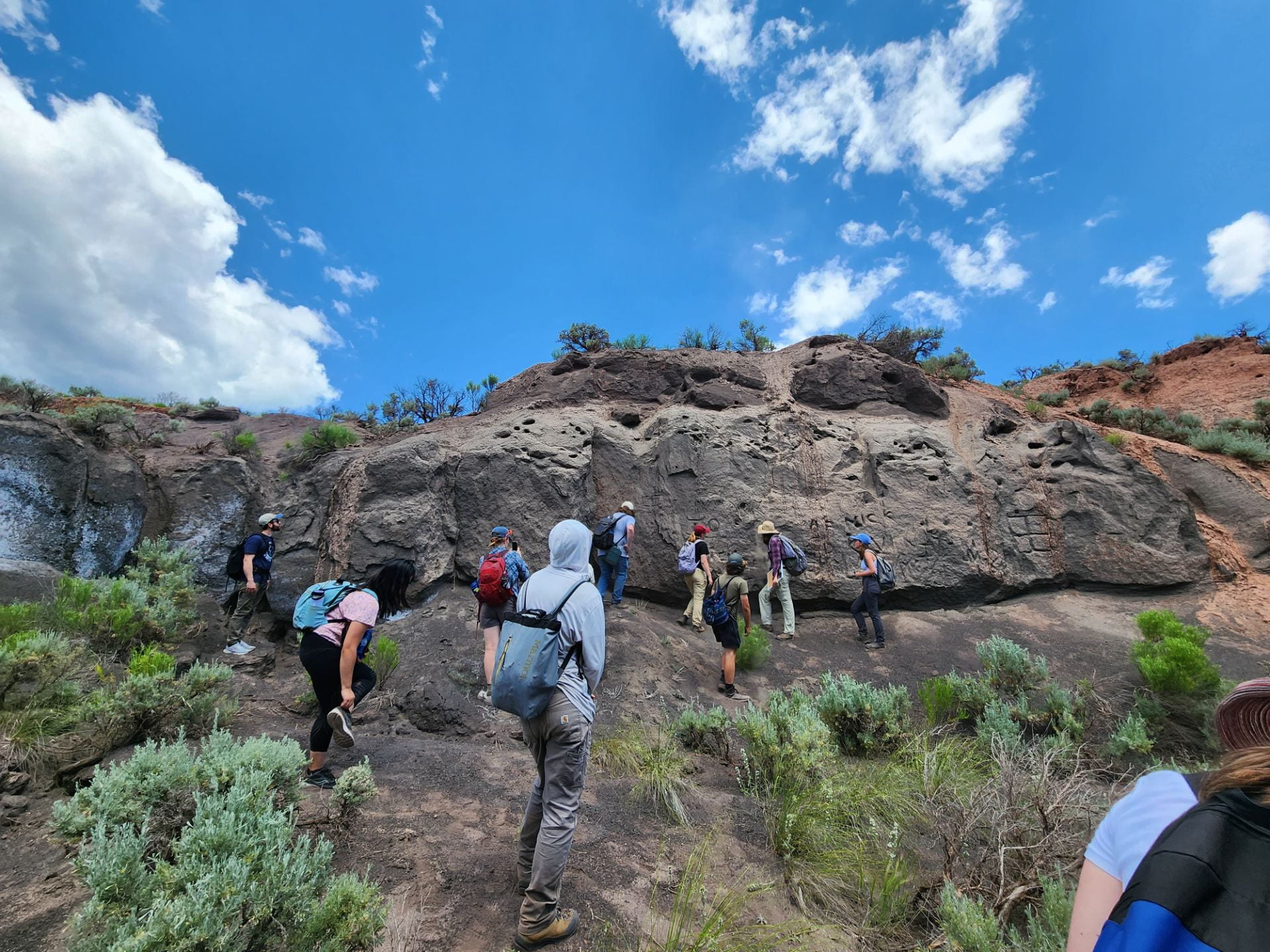
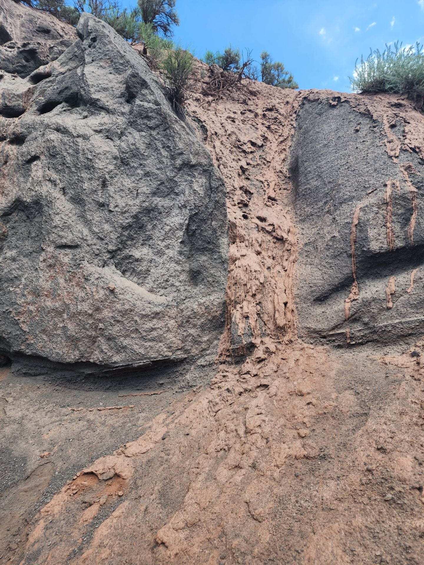
After driving up the tricky mountain road, we made it to the Dotsero Crater! It was an amazing view of the crater, basalt outcrops and the surrounding mountains. There was vegetation growing at the bottom of the crater and along the sides. The red sides of the crater were made of sedimentary rock from the Maroon Formation. Audrey told us about how this volcano formed and erupted 4,000 years ago. As the volcano was forming, layers were built up on the sides from previous eruptions of magma flowing down the sides of the mountain. When the volcano erupted, it created a crater by blasting material out. Will and Audrey explained that this eruption was likely a phreatomagmatic eruption, where groundwater and magma interacted to create a steam-driven explosion. The shape of the volcano is a maar, where the volcano settles into the ground and creates a cone-shape depression. We hiked around the crater to an outcrop of lapilli tuff. The outcrop was coarse grained and was easily broken away by hand. We observed streams of clay coming down along the outcrop. We then hiked back towards the crater to examine a basaltic outcrop and enjoy lunch with gorgeous views! We observed that the layers of volcanic rock mimicked the cone shape of the volcano we discussed earlier.
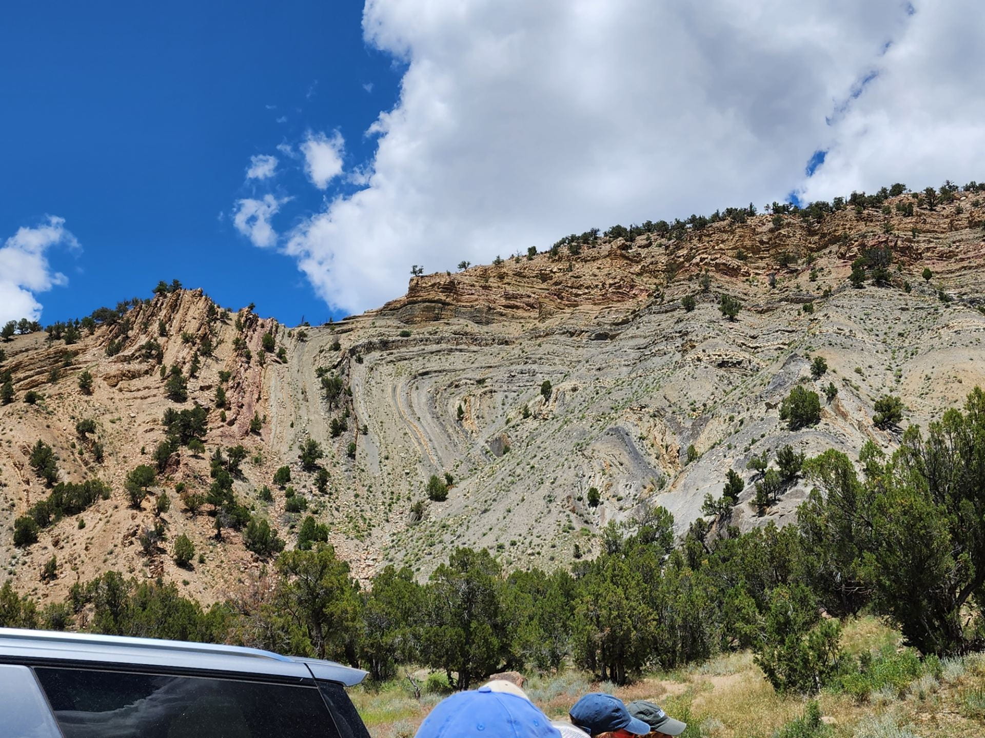
Stop 4 – Sweetwater fold
Our last of the day was the Sweetwater Fold. This is part of the Eagle Valley Formation and formed from soft salt layers folded and deformed. Stewart taught us about the meanings of syncline and anticline.