
By Elizabeth Mann
Day 2: Saturday 19 June
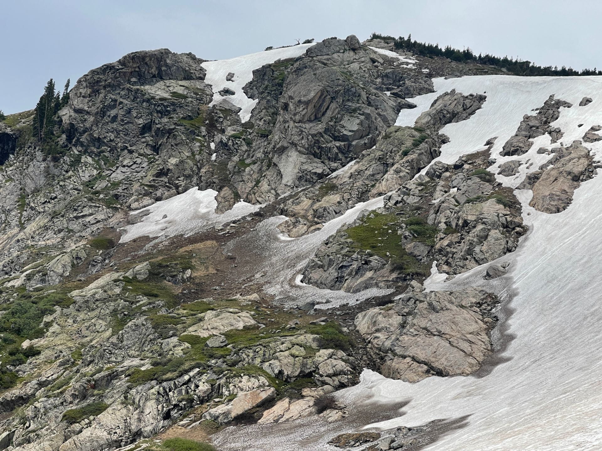
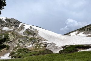
The second day of our Colorado Field Experience began with an early Saturday morning departure to “Saint Mary’s Glacier,” located near Idaho Springs in the Arapaho National Forest. This excursion would be the very first time many of our REU students would see snow and glacial landforms!
Expectations for the Day:
Chris: “As it will be my first time visiting any glaciated terrain, I hope to observe the geological and biological environment created by glaciers up close. I expect to see evidence of some glacial retreat and stress marks on the surrounding rocks from glacial movement. I’m extremely curious to see what, if any, vegetation surrounds the glaciers and learn how it’s able to survive in these conditions.”
Neel: “I am looking forward to seeing the semi-permanent snow field and also getting a chance to see the temperature variations within the glacier with a thermal camera. Also want to see how the movement of glaciers impacts their surrounding areas.”
Going directly from sea level to high levels of elevation within only 48 hours, meant that many of us were not accustomed to the lower levels of oxygen! Upon our arrival, the first task at hand was to make the slow and arduous trek up to the base of the glacier. When we finally reached the halfway point we ran into a small section of dirty ice where we had the opportunity to test out the thermal camera. We then continued up to the base of the ice, rounded the corner and got our first glimpse of Saint Mary’s Glacier in its full, vast beauty.
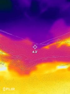
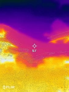
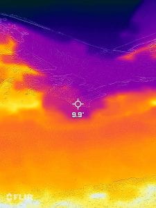
Farther up the trail where the ice hit the rocks near our feet, we could see the differences in the temperatures of the ice field from the thermal camera. Trinity Lavenhouse’s above images of the ice using the FLIR ONE thermal imaging camera capture the surface ice temperature from the thickest at the top (4.3 degrees celsius on the left hand image), to where the ice is thinest at the ice-rock interface (9.9 degrees on the far right image). Where the temperatures were highest (indicated by the lighter orange and yellow colors) the ice was the dirtiest, showing that the darker rock absorbed more of the sun’s radiation.
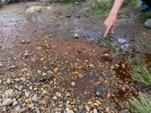
Right as we made it to a stopping point for lunch, ominous black rain clouds began to darken the horizon. We enjoyed the view for about two minutes before quickly beginning our descent. On our way down, we made a quick stop at the small stream where the lake drained to view iron oxidizing bacteria. Dr. Mark Torres explained that this process only occurs in anoxic and low energy environments, where the orange coloration indicates the presence of bacteria that converts the iron into a food source.
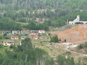
As we reached the end of the trail, we all finished in a half-run, piling into the van right as the first raindrops hit the ground. We opened our lunches to the sound of torrential rain pounding the outside of the van. As we drove back towards the hotel, the rain eventually subsided and we stopped just outside the abandoned mining town of Gilman. From the side of the road, grad student Jackson Borchardt talked briefly about the mining process, and showed us some of the igneous rock specimens that he found close by that come from the Pando porphyry formed in the early Paleocene period, which were being mined for zinc. The town had been abandoned since the 1980’s as a result of the mining industry crash.
When we made it back to the hotel, Kayla and I started “brinner” (breakfast for dinner) which consisted of eggs, bacon, biscuits, and pancakes. After we were done cooking, the entire kitchen was coated in a very fine layer of flour which we left for the cleaning crew to take care of (sorry Zach and Neel!)
After dinner, Dr. Sylvia Dee gave a talk about climate change, its impact on the environment, and how glaciers affect Earth’s surface temperatures which play a vital role in climate change. This last part is known as a ‘positive feedback climate cycle’ called the “Ice Albedo Effect.” The ice and snow that form glaciers reflect the solar radiation from the sun which in turn actually keeps the Earth’s surface cool, but because of global temperatures rising, glaciers are melting and thus decreasing the amount of reflected solar radiation. This results in warming of the oceans and causes the Earth’s surface temperatures to increase, giving us the term global warming.
What We Learned and Found:
Janae: “Yesterday was my first time ever seeing a glacier. Upon arrival, I expected to see how the glaciers’ movement affected its surrounding areas. However, due to the weather, we did not spend much time observing the area. The one thing in particular that I found interesting was the lake near the glacier that was more than likely formed from it melting.”
Zach: “It was really interesting to observe how the dominant plant species changed as we climbed higher up the mountain, moving from full-sized trees to bushes and finally to very small flowering plants. Mountains such as that associated with St. Mary’s Glacier have such a huge array of environments and niches that different organisms are adapted to, and I really appreciated seeing these changes during the hike today. It is interesting to consider the numerous impacts that the glacier has had on the flora and fauna on both relatively short and long timespans, shaping the macro- and micro-environments that were so evident on our hike today.”